


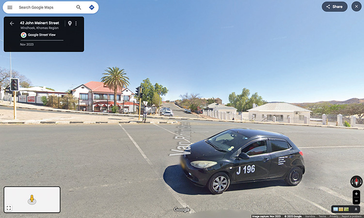
Google has announced that Google Street View is now available in Namibia, allowing viewers to virtually explore.
The announcement was made by Google, making Namibia the latest nation to be featured on the platform.
The new feature provides 360-degree panoramic images of streets and landmarks, accessible through Google Maps.
“Namibia, a land of breathtaking landscapes and rich cultural heritage, is now more accessible than ever! Google Street View allows you to virtually explore this stunning southern African nation and immerse yourself in its unique charm from your screen,” the statement reads.
Users can access the imagery by opening Google Maps on a computer and dragging the ‘Pegman’ icon to a desired location.
The coverage spans over 21 000km, covering a wide range of towns and cities.
These include Windhoek, Walvis Bay, Swakopmund, Grootfontein, Henties Bay, Karasburg, Keetmanshoop, Mariental, and Otjiwarongo.
Several notable landmarks are also included in the Street View imagery.
Among them are the Franke Tower at Omaruru, and the Christuskirche and Independence Memorial Museum in Windhoek.
Coastal views, such as the landscape overlooking Penguin Island at Lüderitz and the town’s concrete letters also feature.
Additionally, the Rosh Pinah Museum at Rosh Pinah can be viewed.