





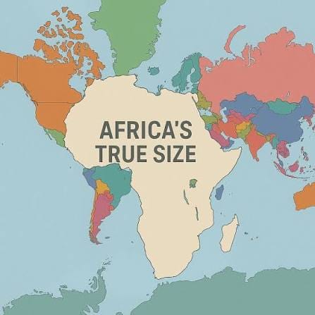
The African Union has welcomed a recent United Nations General Assembly resolution calling for a more accurate representation of Africa on world maps.
The initiative centres on the Mercator projection, a 16th-century map designed mainly for navigation, which distorts the relative size of land areas and makes Africa appear significantly smaller than its actual surface area.
The resolution, championed by Togo on behalf of the African Group, seeks to address long-standing concerns over the way Africa’s size is portrayed on commonly used maps.
African Union (AU) Commission chairperson Mahmoud Ali Youssouf in a statement on Friday commends Togo for leading the initiative and president Faure Gnassingbé for mobilising international support.
Youssouf also praises AU member states and the African Group in New York for a united effort behind the resolution.
The AU says the resolution is not only about cartography, but also about ensuring Africa is represented according to objective and scientifically established realities.
Youssouf calls on international institutions, schools, publishers and digital platforms to progressively adopt maps that provide a more accurate representation of the world’s land areas.
“The African Union Commission will continue to work with Togo, member states and relevant partners to support efforts towards the implementation of this initiative,” he says.
The AU says the adoption marks an important step towards changing how Africa is visually represented globally.
“Africa must be represented as it truly is: in its true dimensions and in its rightful place in the world,” Youssouf says.