


THE Walvis Bay municipality has revived discussions to extend the town’s municipal boundaries back to the 1910 original area of jurisdiction.
During the council’s ordinary meeting on Tuesday, councillors recommended that a new application for the expansion of the town’s municipal boundaries to its originality be submitted to the Ministry of Urban and Rural Development.
Discussions to extend the town’s borders started 15 years ago.
According to council minutes read by the chairperson of the management committee, Richard Hoaeb, the need for the town boundary extension is necessitated by an urgent need for land for housing and industrial development.
Hoaeb added that the town cannot expand further as it is physically constrained on the west by the Atlantic and on the northern side by the future establishment of the North Port of Walvis Bay.
“The only area of possible growth is therefore on the eastern side. However, the eastern side is largely state land. Hence, the necessity to extend the existing municipal boundaries to the original boundaries,” he said.
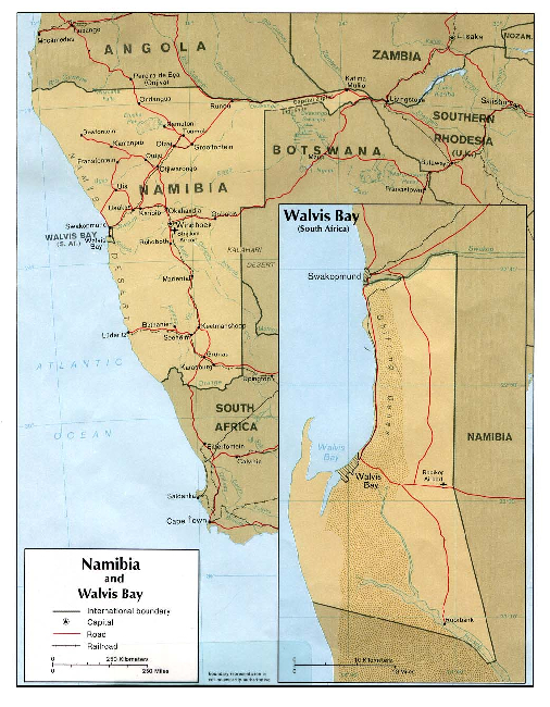
The municipal area of jurisdiction was altered by the new dispensation in 1994, in accordance with Government Gazette No. 873 dated 10 June 1994, when Walvis Bay was reintegrated into Namibia.
At the time, the population of the town was estimated to be 20 000. Over the years, the population grew to current estimates of over 90 000, and large portions of the town are also in the hands of private developers.
According to a 1978 map, the municipal area of jurisdiction is estimated to be 1 124 square kilometres along 60km of coastline.
This includes the airport, dunes, wetlands, Kuiseb River, Rooibank in the desert, and Sandwich Harbour. It stretches up to the middle of the Swakop River at the bridge south of Swakopmund.
However, the town’s boundaries only cover an area of 17,2 square kilometres, which is enclaved by dunes.
Hoaeb further explained that the suburb of Kuisebmond has two blocks left before it runs out of space.
“The municipality is already in the process of establishing townships on those two remaining blocks. Hence, land for future low-income housing is urgently required. The areas on the eastern side of Narraville are reasonably flat and easier to develop into low to medium-income housing areas compared to the dunes area towards the north. However, the said land area is state land,” he said.
He added that the required land is not only for residential purposes but also for industrial development, as the existing areas are fully occupied.
If the town boundary extension is granted, the council believe it will enable the municipality to better manage and control tourist hotspots such as Dune 7 and the beach north of Langstrand, which forms part of Dorob National Park.
This, they say, is because the municipality has statutory measures in place to protect and safeguard the environment.
“The municipality further acknowledges that the alterations of the municipal boundary do not mean the partial de-proclamation of Dorob National Park,” said Hoaeb.
He further explained that the application to have the town’s boundaries restored to the original municipal area of jurisdiction is to avoid additional submissions in future.